


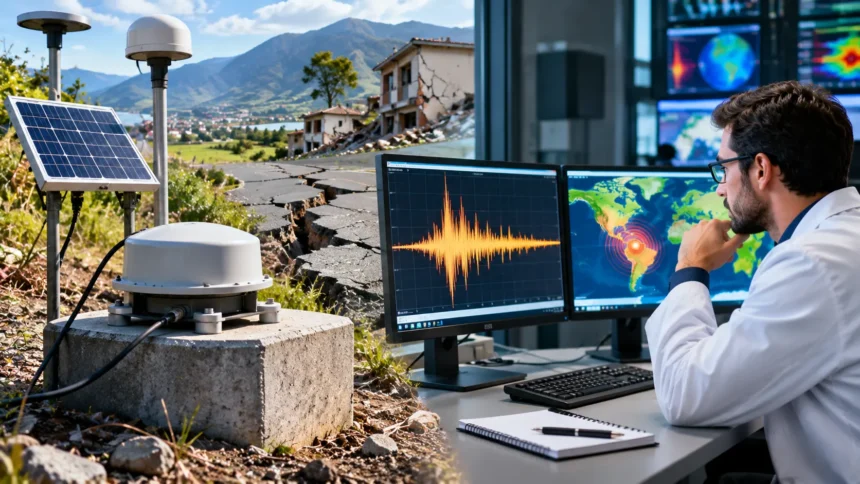
Earthquakes are among the most powerful natural events on Earth, capable of shaking buildings, changing landscapes, and affecting entire communities within seconds. Some earthquakes are so small that people never notice them, while others release enormous amounts of energy. Scientists use advanced instruments, monitoring networks, and mathematical calculations to detect earthquakes and understand their strength.
But how do scientists detect and measure powerful earthquakes when the shaking happens deep underground? The answer involves seismic waves, sensitive measuring instruments, earthquake magnitude scales, and real-time monitoring technology. This guide explains how scientists locate earthquakes, calculate their magnitude, measure ground shaking, and use modern technology to improve earthquake monitoring and public safety.
What Causes Powerful Earthquakes?
Earthquakes occur when rocks within Earth’s crust or upper mantle suddenly move along a fracture called a fault. Tectonic forces can build stress in rocks over long periods. When the stress exceeds the strength of the rocks or friction holding them in place, sudden movement releases energy that travels through the Earth as seismic waves.
Most powerful earthquakes occur near tectonic plate boundaries, where enormous sections of Earth’s outer shell interact. Some plates collide, others move apart, and some slide past each other. These movements create stress along faults that may eventually produce earthquakes ranging from small tremors to major destructive events.
The largest earthquakes generally occur along subduction zones, where one tectonic plate moves beneath another. These regions can produce extremely powerful earthquakes because enormous fault areas may rupture. Scientists study plate movements, geological structures, and past earthquakes to understand where significant seismic activity is more likely to occur.
How Do Scientists Detect Earthquakes?
Scientists detect earthquakes by measuring vibrations produced when seismic waves travel through the ground. These vibrations can be extremely small or powerful enough to cause noticeable shaking. Specialized instruments record ground movement and help researchers determine whether an earthquake has occurred, even when people do not feel it.
Earthquake monitoring stations operate in many countries and continuously collect information about ground motion. When an earthquake occurs, seismic waves reach different stations at different times. Scientists use these recordings to identify unusual activity and distinguish earthquake signals from vibrations caused by traffic, machinery, or other sources.
Modern monitoring networks can detect earthquakes automatically using computer systems that analyze incoming seismic data. These systems identify wave arrivals and estimate important earthquake characteristics. Human seismologists may then review the information, especially after large earthquakes, to improve the accuracy of reported locations and magnitudes.
What Is a Seismometer and How Does It Work?
A seismometer is a sensitive instrument designed to detect and measure ground motion. It responds to vibrations generated by earthquakes and other sources of seismic activity. Modern instruments use electronic sensors to measure movement, allowing scientists to record signals that may be too small for people to notice.
The basic principle involves measuring movement relative to a reference mass or another sensing mechanism. When the ground moves, the instrument detects changes and converts them into measurable signals. Different seismometers are designed to measure ground displacement, velocity, or acceleration, depending on their purpose and construction.
Seismometers are installed in carefully selected locations to reduce interference from unnecessary vibrations. Some are placed underground or inside specially designed structures. Their recordings help researchers study earthquake activity, identify seismic waves, and understand how energy travels through different layers of the Earth.
What Is a Seismograph and a Seismogram?
The terms seismometer and seismograph are closely related, although they describe slightly different aspects of earthquake measurement. A seismometer is the sensing instrument that measures ground motion. A seismograph refers to the recording system, sometimes including the sensor, that produces a record of seismic activity.
The recorded signal is called a seismogram, which displays how ground movement changes over time. Scientists examine these records to identify different seismic waves and measure their characteristics. The timing, amplitude, and shape of the recorded signals provide valuable clues about the earthquake’s location and strength.
Seismograms can also reveal smaller earthquakes that occur before or after a major seismic event. Researchers compare recordings from multiple stations to build a clearer picture of underground activity. These records support earthquake research and help improve models of how seismic waves behave.
How Do Seismic Waves Help Detect Earthquakes?
Seismic waves are vibrations that carry energy through the Earth after an earthquake occurs. Scientists study these waves because their speed, direction, and movement patterns reveal important information about the source. Different types of seismic waves behave differently, making them useful for locating earthquakes and studying Earth’s internal structure.
Primary waves, commonly called P-waves, are the fastest major seismic waves and generally arrive at monitoring stations first. They travel by compressing and expanding material in the direction of movement. P-waves can travel through solids, liquids, and gases, although their speed depends on the properties of the material.
Secondary waves, known as S-waves, arrive after P-waves and move material perpendicular to their direction of travel. They cannot pass through liquids. Surface waves travel along Earth’s surface and can contribute significantly to damaging shaking, particularly when their motion and duration affect buildings and infrastructure.
How Do Scientists Locate an Earthquake’s Epicenter?
The epicenter is the point on Earth’s surface directly above the location where an earthquake rupture begins. The underground starting point is called the hypocenter or focus. Scientists estimate these locations by analyzing seismic waves recorded at different monitoring stations.
One important method involves comparing the arrival times of P-waves and S-waves. Because P-waves travel faster, the time difference between their arrivals generally increases with distance from the earthquake. Scientists use travel-time models to estimate how far a station is from the seismic source.
By combining information from several stations, researchers calculate the earthquake’s likely location. Modern computer systems use many observations and models of seismic wave speeds to improve these estimates. Initial earthquake locations may be revised as additional data becomes available, especially for events occurring offshore or in regions with fewer monitoring stations.
How Do Scientists Measure Earthquake Magnitude?
Earthquake magnitude describes the overall size of an earthquake using measurements derived from seismic recordings. Scientists analyze the characteristics of recorded waves to estimate the energy released by fault movement. Magnitude is different from the shaking experienced at one location, which can vary depending on distance and geological conditions.
The magnitude scale is logarithmic rather than linear. An increase of one magnitude unit corresponds to approximately ten times greater measured wave amplitude on traditional magnitude scales. It also represents roughly 32 times more energy release, making the difference between large earthquakes far greater than the numbers initially suggest.
For example, a magnitude 7 earthquake releases approximately 32 times more energy than a magnitude 6 earthquake. A magnitude 8 event releases roughly 1,000 times more energy than a magnitude 6 event. These comparisons help explain why relatively small differences in reported magnitude can represent enormous differences in earthquake size.
What Is the Richter Scale?
The Richter scale was developed by Charles F. Richter in 1935 to measure the magnitude of earthquakes recorded in southern California. It used the amplitudes of seismic waves measured by particular instruments, with corrections for distance. The scale provided an important early method for comparing earthquake sizes consistently.
The original Richter scale worked particularly well for certain local earthquakes but had limitations when applied to very large or distant events. Different magnitude scales were later developed for different types of seismic waves. These improvements helped scientists obtain more reliable measurements across a wider range of earthquake sizes.
Although people still commonly refer to the Richter scale, scientists generally use other magnitude measurements for major earthquakes. The moment magnitude scale is now preferred for many large events. Understanding this distinction helps explain why modern earthquake reports may describe magnitude without specifically identifying it as a Richter measurement.
What Is the Moment Magnitude Scale?
The moment magnitude scale, written as Mw, is widely used to describe the size of large earthquakes. It is based on seismic moment, a measure related to the fault area that moves, the average amount of movement, and the rigidity of the surrounding rocks. This provides a physical basis for estimating earthquake size.
Scientists calculate seismic moment using seismic recordings and models of the earthquake rupture. For large earthquakes, they may analyze long-period waves and additional information about fault movement. The resulting moment magnitude allows researchers to compare events across different regions and tectonic environments.
One advantage of moment magnitude is that it avoids some limitations of older magnitude scales when measuring extremely large earthquakes. It provides more consistent comparisons of major events. However, estimates can still change as researchers collect additional observations and improve their understanding of the rupture.
What Is the Difference Between Magnitude and Intensity?
Magnitude and intensity describe different aspects of an earthquake. Magnitude represents the overall size of the seismic event and is usually reported as one value. Intensity describes the strength of shaking and its effects at a particular location, meaning one earthquake can produce different intensity levels across an affected region.
An earthquake may create severe shaking near its source but weaker movement farther away. Local soil conditions, rock properties, and building characteristics can also influence the experienced effects. Consequently, two communities located at similar distances from an earthquake may report different levels of shaking and damage.
Scientists often use the Modified Mercalli Intensity scale to describe observed earthquake effects. This scale ranges from I, representing shaking that is not felt, to XII, representing extreme effects. Unlike magnitude measurements, intensity assessments consider observations of movement, people’s experiences, and damage to structures.
How Do Scientists Measure Ground Shaking and Acceleration?
Scientists use instruments called accelerometers to measure how quickly ground velocity changes during earthquake shaking. These devices are particularly important for recording strong motion close to major earthquakes. Their measurements help researchers understand forces that can affect buildings, bridges, roads, and other structures.
One commonly reported measurement is peak ground acceleration, which represents the highest recorded acceleration during an earthquake at a specific location. Engineers use this information to study how structures respond to shaking. Peak ground velocity and other measurements can also help describe the severity and characteristics of ground movement.
Strong-motion data provides valuable information for improving earthquake-resistant construction. Researchers compare measurements with observed structural performance to understand how different buildings respond. However, damage depends on several factors, including shaking duration, frequency, construction quality, and local geological conditions rather than acceleration alone.
How Do Scientists Measure Powerful Underwater Earthquakes?
Underwater earthquakes often occur along tectonic plate boundaries beneath the ocean floor. Scientists detect many of these events using land-based seismic stations that record waves traveling through the Earth. Ocean-bottom seismometers can provide additional measurements from locations closer to offshore earthquake sources.
Some underwater earthquakes cause sudden movement of the seafloor, potentially displacing large volumes of water. When the displacement is sufficient, it can generate tsunami waves. However, not every underwater earthquake produces a tsunami, and the likelihood depends on factors such as magnitude, depth, and fault movement.
Scientists use seismic information, ocean pressure sensors, and coastal water-level measurements to evaluate possible tsunami threats. Deep-ocean monitoring systems can detect unusual changes associated with passing tsunami waves. These observations help warning centers assess the situation and issue updates when dangerous coastal conditions may develop.
How Does GPS Help Scientists Monitor Earthquakes?
Global Navigation Satellite System technology, including GPS, allows scientists to measure small changes in the positions of Earth’s surface. High-precision monitoring stations can detect gradual ground movement caused by tectonic plate activity. These measurements provide information about how stress builds around faults over time.
During large earthquakes, the ground may shift permanently by measurable amounts. GPS and other satellite-based positioning technologies can record these changes and help scientists estimate the movement involved. This information complements traditional seismic measurements by showing how the Earth’s surface responds to major fault ruptures.
Scientists also use satellite radar techniques to map ground deformation across large areas. By comparing images collected at different times, researchers can identify changes associated with earthquakes. Combining satellite observations with seismic records helps improve understanding of fault behavior, earthquake mechanisms, and regional geological hazards.
How Do Earthquake Early Warning Systems Work?
Earthquake early warning systems aim to detect an earthquake shortly after it begins and provide alerts before stronger shaking reaches some locations. These systems rely on networks of seismic sensors and rapid computer analysis. They do not predict earthquakes before they start, but they can provide useful warning time in certain circumstances.
When sensors detect the first seismic waves, automated systems estimate the earthquake’s location and expected shaking. Because electronic communications travel faster than seismic waves, an alert may reach people or equipment before damaging shaking arrives. The available warning time depends on distance, system performance, and the earthquake’s characteristics.
Some locations may receive several seconds or more of warning, while areas close to the source may receive little or none. Early warning systems can support protective actions and automated safety procedures. However, they cannot guarantee advance notice for every earthquake or eliminate the risks associated with strong shaking.
Can Scientists Predict Powerful Earthquakes?
Scientists cannot currently predict the exact time, location, and magnitude of a future major earthquake with reliable accuracy. Although researchers understand many processes responsible for earthquakes, fault systems behave in complex ways. Changes in stress and seismic activity do not provide a dependable timetable for when a specific earthquake will occur.
Instead, scientists develop earthquake hazard assessments that estimate the likelihood of certain levels of shaking over longer periods. These assessments use historical earthquake records, geological studies, fault information, and mathematical models. Their findings help communities understand regional risks and develop appropriate building standards and preparedness plans.
Earthquake forecasting and earthquake early warning are not the same as exact prediction. Forecasts describe probabilities over specified periods, while early warning systems respond after an earthquake has already started. Recognizing these differences helps people interpret scientific information accurately and avoid misleading claims about precise earthquake predictions.
Why Do Some Earthquakes Cause More Damage Than Others?
Earthquake damage depends on more than magnitude alone. An earthquake’s depth, distance from populated areas, shaking duration, and local ground conditions all influence its effects. A relatively moderate earthquake near vulnerable buildings can sometimes cause greater local damage than a larger event occurring far from communities.
Shallow earthquakes may create particularly strong shaking near the source because seismic energy travels a shorter distance to the surface. Soft sediments can amplify certain kinds of ground movement, while unstable soils may experience liquefaction under suitable conditions. These geological factors can make damage vary considerably across nearby locations.
Building design and construction quality also strongly influence earthquake consequences. Structures designed and maintained to resist seismic forces may perform better than vulnerable buildings exposed to similar shaking. Scientists and engineers use earthquake measurements to improve construction standards, infrastructure planning, and public preparedness strategies.
What Do Scientists Learn From Major Historical Earthquakes?
Historical earthquakes provide important evidence about how powerful seismic events affect the Earth and human communities. Scientists study written accounts, geological changes, and preserved damage patterns to investigate events that occurred before modern instruments existed. These records help researchers estimate past earthquake locations, sizes, and possible recurrence patterns.
The 1960 Chile earthquake is widely recognized as the largest instrumentally recorded earthquake, with a moment magnitude of approximately 9.5. The 1964 Alaska earthquake, estimated at magnitude 9.2, is another important event in seismic research. Both earthquakes helped scientists understand large fault ruptures and the effects of powerful seismic activity.
The 2004 Sumatra-Andaman earthquake and the 2011 Tōhoku earthquake in Japan also contributed valuable scientific observations. Their associated tsunamis demonstrated the importance of offshore monitoring and coastal warning systems. Researchers continue examining these events to improve earthquake models, hazard assessments, and emergency planning.
How Technology Is Improving Earthquake Detection
Modern earthquake monitoring systems increasingly use digital sensors, automated processing, and high-speed communication networks. These technologies allow scientists to collect information from many stations and analyze it rapidly. Improved instruments can detect smaller events and provide detailed recordings that help researchers investigate complex earthquake sequences.
Machine learning is also being explored to identify seismic signals and assist with earthquake detection. Computer models can analyze large collections of recordings and recognize patterns that may be difficult to review manually. However, automated methods require careful testing and validation to maintain reliable results.
New monitoring approaches include using fiber-optic cables to detect vibrations along extended distances. This technique, known as distributed acoustic sensing, may provide additional observations in selected environments. Combined with traditional instruments and satellite measurements, emerging technologies are expanding scientists’ ability to study earthquakes and improve seismic monitoring.
How Earthquake Measurements Help Protect Communities
Accurate earthquake measurements support emergency response by providing information about an event’s location, magnitude, and potential shaking effects. Authorities can use these estimates to identify areas that may require immediate attention. Rapid assessments are particularly useful when transportation, communication, or other important infrastructure has been disrupted.
Earthquake data also helps engineers develop seismic design standards for buildings and essential facilities. By studying ground acceleration, shaking duration, and geological conditions, researchers can estimate the forces structures may experience. This knowledge supports safer construction practices and improvements to existing infrastructure in earthquake-prone regions.
Public education and preparedness remain important even with advanced monitoring technology. People living in seismic regions benefit from knowing appropriate protective actions and understanding local emergency guidance. Earthquake detection systems provide valuable information, but community planning and resilient construction are essential parts of reducing disaster risks.
Conclusion
Scientists detect and measure powerful earthquakes using seismometers, seismic networks, satellite technology, and advanced computer systems. These tools record ground movement, identify seismic waves, and help determine where earthquakes begin. By comparing measurements from different locations, researchers can calculate earthquake magnitude and study the characteristics of major seismic events.
Modern earthquake science uses the moment magnitude scale to describe the size of many powerful earthquakes. Scientists also measure ground acceleration and shaking intensity to understand how earthquakes affect different locations. These measurements help researchers investigate fault movement, assess hazards, and support the development of safer buildings and infrastructure.
Although scientists cannot reliably predict the exact timing of future earthquakes, detection and early warning technology continue improving. Accurate monitoring helps emergency authorities respond to events and provides valuable information for long-term preparedness. Understanding how earthquakes are measured reveals the important role science plays in protecting communities from seismic hazards.
Frequently Asked Questions
What instrument do scientists use to detect earthquakes?
Scientists primarily use seismometers to detect vibrations caused by earthquakes. These instruments record ground motion, allowing researchers to identify seismic waves, locate earthquakes, and estimate their magnitude using information from monitoring networks.
How do scientists measure the strength of an earthquake?
Scientists measure earthquake size using magnitude scales, especially the moment magnitude scale for large events. They also assess local shaking using intensity scales and instruments that measure ground acceleration and movement.
What is the difference between the Richter scale and moment magnitude?
The original Richter scale uses recorded seismic wave amplitudes to estimate earthquake size. Moment magnitude relates to the physical size of fault movement and provides more consistent measurements for very large earthquakes.
Can scientists detect an earthquake before it happens?
Scientists cannot reliably predict exactly when an earthquake will occur. However, early warning systems can detect an earthquake after it begins and sometimes alert distant locations before stronger shaking arrives.
What is the most powerful earthquake ever recorded?
The 1960 Valdivia earthquake in Chile is the largest instrumentally recorded earthquake, with an estimated moment magnitude of 9.5. It caused widespread damage and generated a tsunami affecting coastal regions.